House of the Good Shepherd, Upper Welland
Introduction
The photograph on this page of House of the Good Shepherd, Upper Welland by Bob Embleton as part of the Geograph project.
The Geograph project started in 2005 with the aim of publishing, organising and preserving representative images for every square kilometre of Great Britain, Ireland and the Isle of Man.

There are currently over 7.5m images from over 14,400 individuals and you can help contribute to the project by visiting https://www.geograph.org.uk
House of the Good Shepherd, Upper Welland
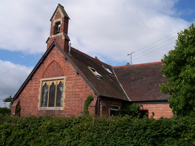
Image: © Bob Embleton Taken: 22 May 2005
Now expanded into a private dwelling, but built as a Church of England "Chapel of Ease" when Upper Welland developed from a scatter of timber framed houses around the common land of "Lower Assarts" into a village after the 1851 inclosures.
Images are licensed for reuse under creativecommons.org/licenses/by-sa/2.0
Image Location


Leaflet Map data © OpenStreetMap
Latitude
52.066922
Longitude
-2.325264