Chesterfield Canal, Renishaw
Introduction
The photograph on this page of Chesterfield Canal, Renishaw by David Morris as part of the Geograph project.
The Geograph project started in 2005 with the aim of publishing, organising and preserving representative images for every square kilometre of Great Britain, Ireland and the Isle of Man.

There are currently over 7.5m images from over 14,400 individuals and you can help contribute to the project by visiting https://www.geograph.org.uk
Chesterfield Canal, Renishaw
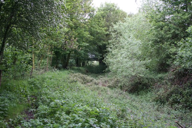
Image: © David Morris Taken: 20 May 2006
According to old maps, this is where the original route and the current route parted company. In front, you can just make out one of the bridges built to get what's now a bridle path across the combined width of the railway and new cut. The original path goes off to the north-west, hugging the 55m contour line and rejoins the original path in Image I assume the 'new cut' was done by the railway builders, looking at the bridges and cutting. I don't know the date, but it's certainly prior to 1907 because the 1907 OS map shows the new cut.
Images are licensed for reuse under creativecommons.org/licenses/by-sa/2.0
Image Location


Leaflet Map data © OpenStreetMap
Latitude
53.302479
Longitude
-1.332213