Prestwood Arms
Introduction
The photograph on this page of Prestwood Arms by John M as part of the Geograph project.
The Geograph project started in 2005 with the aim of publishing, organising and preserving representative images for every square kilometre of Great Britain, Ireland and the Isle of Man.

There are currently over 7.5m images from over 14,400 individuals and you can help contribute to the project by visiting https://www.geograph.org.uk
Prestwood Arms
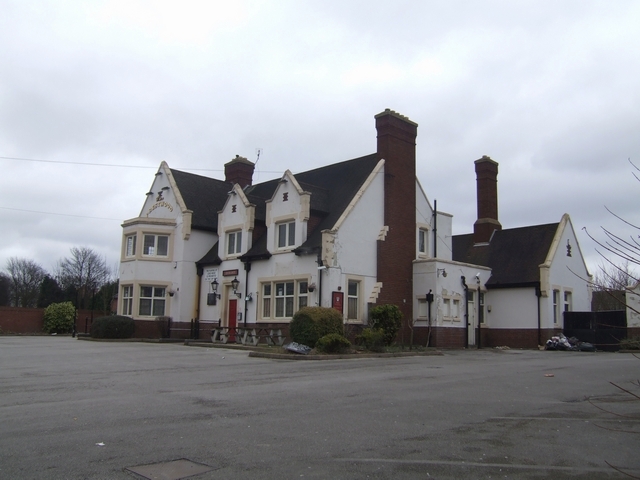
Image: © John M Taken: 13 Mar 2010
Locally listed pub building in a 'Tudor revival' style. Planning permission has been granted for a 62 bed care home on the site. There is a current trend within the city for care home developmments on pub sites with several complete and others in the pipeline. As can be seen the value of a 'local listing' is almost worthless if the economics of retaining the building are considered.
Images are licensed for reuse under creativecommons.org/licenses/by-sa/2.0
Image Location
Latitude
52.603326
Longitude
-2.097261