Culloden House ice house
Introduction
The photograph on this page of Culloden House ice house by Richard Dorrell as part of the Geograph project.
The Geograph project started in 2005 with the aim of publishing, organising and preserving representative images for every square kilometre of Great Britain, Ireland and the Isle of Man.

There are currently over 7.5m images from over 14,400 individuals and you can help contribute to the project by visiting https://www.geograph.org.uk
Culloden House ice house
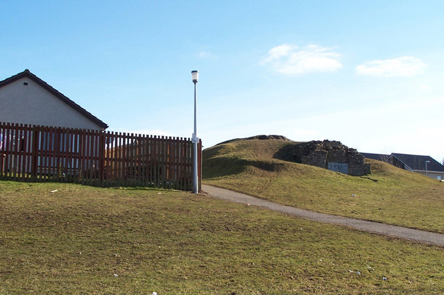
Image: © Richard Dorrell Taken: 9 Mar 2010
The listed building report states: "Early 19th century; single chamber vaulted rubble ice house built into slope; rubble with roughly tooled dressings. Square-headed entrance in rounded north gable; turf roof." The ice house is now partially surrounded by modern housing. Views from on top - Image, Image
Images are licensed for reuse under creativecommons.org/licenses/by-sa/2.0
Image Location
Latitude
57.490626
Longitude
-4.129538