Mangotsfield United Reformed Church
Introduction
The photograph on this page of Mangotsfield United Reformed Church by Linda Bailey as part of the Geograph project.
The Geograph project started in 2005 with the aim of publishing, organising and preserving representative images for every square kilometre of Great Britain, Ireland and the Isle of Man.

There are currently over 7.5m images from over 14,400 individuals and you can help contribute to the project by visiting https://www.geograph.org.uk
Mangotsfield United Reformed Church
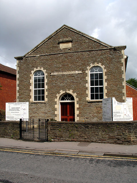
Image: © Linda Bailey Taken: 24 May 2006
Mangotsfield United Reformed Church is situated on Cossham Street. It was originally a congregational Chapel built in 1827. It was enlarged in 1858. (Dates on the upper plaque).
Images are licensed for reuse under creativecommons.org/licenses/by-sa/2.0
Image Location


Leaflet Map data © OpenStreetMap
Latitude
51.483754
Longitude
-2.483683