Kilmaurs Tollbooth
Introduction
The photograph on this page of Kilmaurs Tollbooth by Ian Rainey as part of the Geograph project.
The Geograph project started in 2005 with the aim of publishing, organising and preserving representative images for every square kilometre of Great Britain, Ireland and the Isle of Man.

There are currently over 7.5m images from over 14,400 individuals and you can help contribute to the project by visiting https://www.geograph.org.uk
Kilmaurs Tollbooth
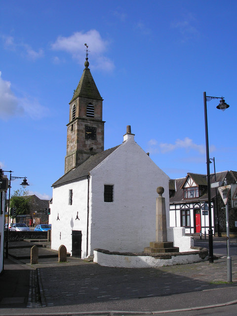
Image: © Ian Rainey Taken: 23 May 2006
The 'Jougs' as it is known locally was the meeting place of the Magistrate and local worthies. It was used as a place of imprisonment and punishment, and the name Jougs comes from the iron neck ring and chain still attached to the external wall near the tower steps. It was also used as a collection point for Custom dues.
Images are licensed for reuse under creativecommons.org/licenses/by-sa/2.0
Image Location
Latitude
55.638272
Longitude
-4.527635