Level Crossing, Southampton
Introduction
The photograph on this page of Level Crossing, Southampton by Peter Trimming as part of the Geograph project.
The Geograph project started in 2005 with the aim of publishing, organising and preserving representative images for every square kilometre of Great Britain, Ireland and the Isle of Man.

There are currently over 7.5m images from over 14,400 individuals and you can help contribute to the project by visiting https://www.geograph.org.uk
Level Crossing, Southampton
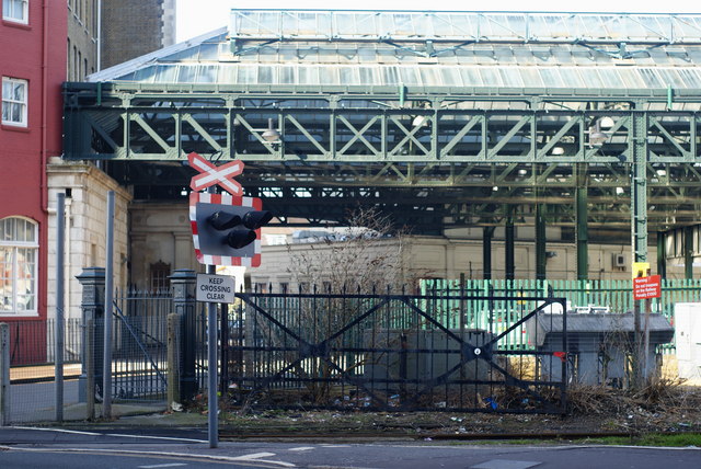
Image: © Peter Trimming Taken: 2 Mar 2010
In the foreground, the railway line can be seen crossing Canute Road; it then continues to the left, into Southampton Docks. Beyond the crossing, can be seen part of the former London & South Western Railway "Southampton Terminus" station. The station opened in 1839, closed in 1966. I recall using this station, either in 1965 or 1966. http://en.wikipedia.org/wiki/Southampton_Terminus_railway_station
Images are licensed for reuse under creativecommons.org/licenses/by-sa/2.0
Image Location
Latitude
50.897183
Longitude
-1.395339