Birmingham and Fazeley Canal towards Aston Junction
Introduction
The photograph on this page of Birmingham and Fazeley Canal towards Aston Junction by Roger D Kidd as part of the Geograph project.
The Geograph project started in 2005 with the aim of publishing, organising and preserving representative images for every square kilometre of Great Britain, Ireland and the Isle of Man.

There are currently over 7.5m images from over 14,400 individuals and you can help contribute to the project by visiting https://www.geograph.org.uk
Birmingham and Fazeley Canal towards Aston Junction
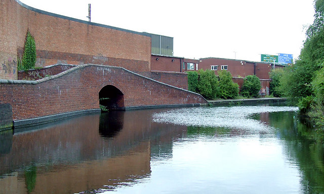
Image: © Roger D Kidd Taken: 9 Sep 2008
The towpath bridges on the left formerly allowed boats into a small arm of the canal, long since filled in. This canal's purpose was to provide a link between Birmingham and the south east of England, by way of the Coventry Canal and the Oxford Canal. John Smeaton was the engineer, and the canal was completed in 1789. The canal now runs from the BCN Main Line at Old Turn Junction, Birmingham to the Coventry Canal at Fazeley Junction, just outside Tamworth. The length is 15 miles (24 km), and it includes 38 locks. (Information from Wiki http://en.wikipedia.org/wiki/Birmingham_and_Fazeley_Canal )
Images are licensed for reuse under creativecommons.org/licenses/by-sa/2.0
Image Location
Latitude
52.490377
Longitude
-1.891252