
Anick Grange and the Tyne valley
Introduction
The photograph on this page of Anick Grange and the Tyne valley by Oliver Dixon as part of the Geograph project.
The Geograph project started in 2005 with the aim of publishing, organising and preserving representative images for every square kilometre of Great Britain, Ireland and the Isle of Man.

There are currently over 7.5m images from over 14,400 individuals and you can help contribute to the project by visiting https://www.geograph.org.uk
Anick Grange and the Tyne valley
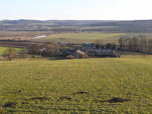
Image: © Oliver Dixon Taken: 4 Mar 2010
Anick Grange from the east end of Anick village. The back road (Corchester Lane) between Hexham and Corbridge runs just beyond, with the main A69 road (where two lorries are visible) a little further away. A reach of River Tyne can be seen in the floor of the valley with the valley of the tributary Devil's Water on the far side. Dipton Wood occupies the hilltop to the left. In the foreground, a very sick rabbit (myxamatosed?).
Images are licensed for reuse under creativecommons.org/licenses/by-sa/2.0
Image Location

Latitude
54.982552
Longitude
-2.067315