Walterston fach - Walterston
Introduction
The photograph on this page of Walterston fach - Walterston by Mick Lobb as part of the Geograph project.
The Geograph project started in 2005 with the aim of publishing, organising and preserving representative images for every square kilometre of Great Britain, Ireland and the Isle of Man.

There are currently over 7.5m images from over 14,400 individuals and you can help contribute to the project by visiting https://www.geograph.org.uk
Walterston fach - Walterston
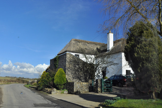
Image: © Mick Lobb Taken: 1 Mar 2010
An extensive thatched building located on the outskirts of the hamlet. Originally two separate 16th/17th century houses joined together by an 18th century middle section. Outbuildings have been modernised and made part of the house.
Images are licensed for reuse under creativecommons.org/licenses/by-sa/2.0
Image Location
Latitude
51.431948
Longitude
-3.340492