Gospel Oak: Lismore Circus Estate: Ludham (2)
Introduction
The photograph on this page of Gospel Oak: Lismore Circus Estate: Ludham (2) by Nigel Cox as part of the Geograph project.
The Geograph project started in 2005 with the aim of publishing, organising and preserving representative images for every square kilometre of Great Britain, Ireland and the Isle of Man.

There are currently over 7.5m images from over 14,400 individuals and you can help contribute to the project by visiting https://www.geograph.org.uk
Gospel Oak: Lismore Circus Estate: Ludham (2)
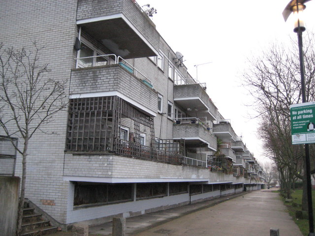
Image: © Nigel Cox Taken: 14 Feb 2010
Ludham, and its parallel housing block, Waxham, are named after two Norfolk villages Image and Image respectively. The blocks are about 240 metres long. This is the south side of Ludham. There are copious images of the estate, when it was brand new, on the English Heritage Viewfinder website. This link goes to an image taken, I think, from virtually the same location http://viewfinder.english-heritage.org.uk/search/reference.aspx?uid=145906&index=12&mainQuery=lismore&searchType=all&form=home
Images are licensed for reuse under creativecommons.org/licenses/by-sa/2.0
Image Location
Latitude
51.552728
Longitude
-0.156646