Wolverley Pound, Wolverley, Worcs
Introduction
The photograph on this page of Wolverley Pound, Wolverley, Worcs by Richard Rogerson as part of the Geograph project.
The Geograph project started in 2005 with the aim of publishing, organising and preserving representative images for every square kilometre of Great Britain, Ireland and the Isle of Man.

There are currently over 7.5m images from over 14,400 individuals and you can help contribute to the project by visiting https://www.geograph.org.uk
Wolverley Pound, Wolverley, Worcs
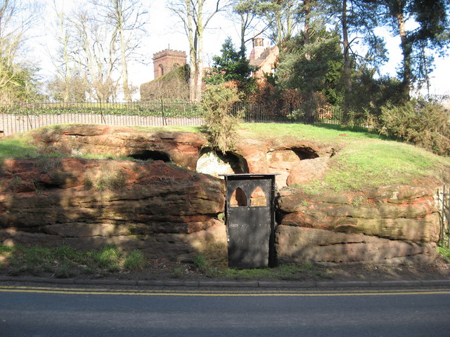
Image: © Richard Rogerson Taken: 20 Feb 2010
The Pound was designed for the “impounding” of wandering cattle and is cut from the solid sandstone rock. There are three covered stalls and a small open area. It was probably cut in the late 1700s and was definitely there in 1771 when at the Court Baron the jury complained that it was ‘out of repair’ and the Lords of the Manor should repair it. They apparently did not as the same complaint was repeated on several occasions. The pound is situated between the road up to the Church and the B4189 near its junction with the B4190. http://www.communigate.co.uk/worcs/wolverleycookleyhistoricalsociety/page6.phtml
Images are licensed for reuse under creativecommons.org/licenses/by-sa/2.0
Image Location
Latitude
52.410261
Longitude
-2.253252