Pond, Powder and Priory Information Panel
Introduction
The photograph on this page of Pond, Powder and Priory Information Panel by David Anstiss as part of the Geograph project.
The Geograph project started in 2005 with the aim of publishing, organising and preserving representative images for every square kilometre of Great Britain, Ireland and the Isle of Man.

There are currently over 7.5m images from over 14,400 individuals and you can help contribute to the project by visiting https://www.geograph.org.uk
Pond, Powder and Priory Information Panel
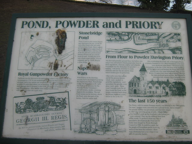
Image: © David Anstiss Taken: 20 Feb 2010
As seen in Image Gives the history of Stonebridge Pond and local area. One of the 41 plaques and information panels around the town.
Images are licensed for reuse under creativecommons.org/licenses/by-sa/2.0
Image Location
Latitude
51.317699
Longitude
0.883886