National Cycle Network Signpost near King's Norton, Birmingham
Introduction
The photograph on this page of National Cycle Network Signpost near King's Norton, Birmingham by Roger D Kidd as part of the Geograph project.
The Geograph project started in 2005 with the aim of publishing, organising and preserving representative images for every square kilometre of Great Britain, Ireland and the Isle of Man.

There are currently over 7.5m images from over 14,400 individuals and you can help contribute to the project by visiting https://www.geograph.org.uk
National Cycle Network Signpost near King's Norton, Birmingham
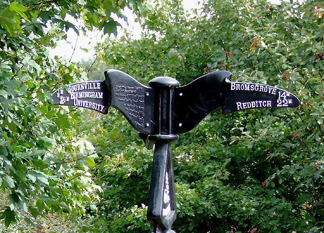
Image: © Roger D Kidd Taken: 8 Sep 2008
This is on the towpath of the Worcester and Birmingham Canal. The post shows local directions and distances for Route No 5 http://www.sustrans.org.uk/what-we-do/national-cycle-network/route-numbering-system/route-5 . This design of Millennium Post is not always painted black. For higher resolution image see: Image]
Images are licensed for reuse under creativecommons.org/licenses/by-sa/2.0
Image Location
Latitude
52.420133
Longitude
-1.919171