2010 : At the end of Court Lane, Bratton
Introduction
The photograph on this page of 2010 : At the end of Court Lane, Bratton by Maurice Pullin as part of the Geograph project.
The Geograph project started in 2005 with the aim of publishing, organising and preserving representative images for every square kilometre of Great Britain, Ireland and the Isle of Man.

There are currently over 7.5m images from over 14,400 individuals and you can help contribute to the project by visiting https://www.geograph.org.uk
2010 : At the end of Court Lane, Bratton
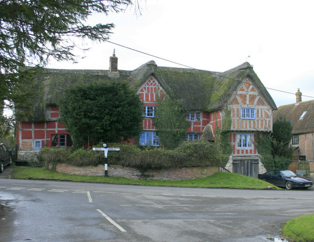
Image: © Maurice Pullin Taken: 21 Feb 2010
Also the end (or beginning) of Trowbridge Road (to the right) and Lower Road (behind the camera). "The civil parish of Bratton, created in 1895, lies within Westbury Hundred and extends over 3,695 acres. The long, narrow shape of the parish is characteristic of the “springline parishes” which lie along the northern edge of Salisbury Plain from Westbury, through Bratton, Edington and West Lavington. Approximately two thirds of the parish lies on chalk downs to the south, rising to a height of over 750 ft. near Bratton Castle Iron Age camp. The northern section of the parish is low-lying clay land, with hedge-enclosed fields. Between chalk and clay lies a belt of Upper Greensand, and the village of Bratton is located at a point where springs emerge from the porous Greensand between the meadow land of the clay vale and the arable and downland above." All the above and more in: http://www.wiltshire.gov.uk/community/getcom.php?id=27
Images are licensed for reuse under creativecommons.org/licenses/by-sa/2.0
Image Location


Leaflet Map data © OpenStreetMap
Latitude
51.272387
Longitude
-2.129824