Aerial view of Southend seafront: western Clifftown and the Pavilion
Introduction
The photograph on this page of Aerial view of Southend seafront: western Clifftown and the Pavilion by Edward Clack as part of the Geograph project.
The Geograph project started in 2005 with the aim of publishing, organising and preserving representative images for every square kilometre of Great Britain, Ireland and the Isle of Man.

There are currently over 7.5m images from over 14,400 individuals and you can help contribute to the project by visiting https://www.geograph.org.uk
Aerial view of Southend seafront: western Clifftown and the Pavilion
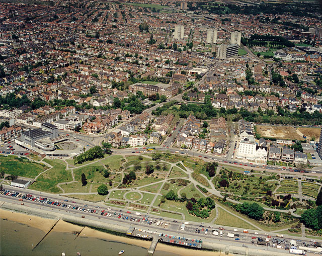
Image: © Edward Clack Taken: 26 May 1988
The Western Esplanade runs just behind the beach here. Above this is Clifftown, the steeply sloping open area. The Cliffs Pavilion is at the extreme left of this area. The previous (eastern) photo in this sequence is Image The next (western) photo is Image
Images are licensed for reuse under creativecommons.org/licenses/by-sa/2.0
Image Location
Latitude
51.534674
Longitude
0.697135