Hancocks Lane on the edge of Castlemorton Common
Introduction
The photograph on this page of Hancocks Lane on the edge of Castlemorton Common by Bob Embleton as part of the Geograph project.
The Geograph project started in 2005 with the aim of publishing, organising and preserving representative images for every square kilometre of Great Britain, Ireland and the Isle of Man.

There are currently over 7.5m images from over 14,400 individuals and you can help contribute to the project by visiting https://www.geograph.org.uk
Hancocks Lane on the edge of Castlemorton Common
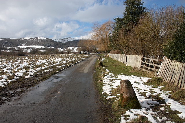
Image: © Bob Embleton Taken: 21 Feb 2010
The homes on the right of the lane have wonderful views across the common. To protect the verge stones have been placed close to the lane. The stones outside this property look like sandstone staddle stone columns and not the usual chunks of local Malvern granite. Looking towards Broad Down and Herefordshire Beacon.
Images are licensed for reuse under creativecommons.org/licenses/by-sa/2.0
Image Location
Latitude
52.053089
Longitude
-2.320788