Plot 50 which I took over at Easter 2009
Introduction
The photograph on this page of Plot 50 which I took over at Easter 2009 by Eugene Farry as part of the Geograph project.
The Geograph project started in 2005 with the aim of publishing, organising and preserving representative images for every square kilometre of Great Britain, Ireland and the Isle of Man.

There are currently over 7.5m images from over 14,400 individuals and you can help contribute to the project by visiting https://www.geograph.org.uk
Plot 50 which I took over at Easter 2009
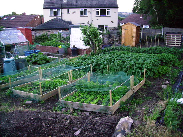
Image: © Eugene Farry Taken: 23 Jun 2009
View of my crops on 26th June with houses on Jackman Drive in background.
Images are licensed for reuse under creativecommons.org/licenses/by-sa/2.0
Image Location
Latitude
53.833181
Longitude
-1.627697