Lytchett Minster: the A35 in sleet
Introduction
The photograph on this page of Lytchett Minster: the A35 in sleet by Chris Downer as part of the Geograph project.
The Geograph project started in 2005 with the aim of publishing, organising and preserving representative images for every square kilometre of Great Britain, Ireland and the Isle of Man.

There are currently over 7.5m images from over 14,400 individuals and you can help contribute to the project by visiting https://www.geograph.org.uk
Lytchett Minster: the A35 in sleet
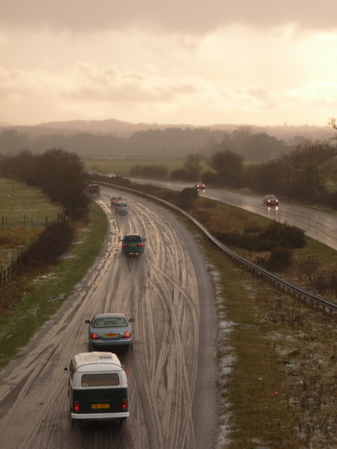
Image: © Chris Downer Taken: 20 Feb 2010
Not ten minutes ago it was a sunny day a couple of miles south. Now, sleet covers the roads in what appeared to be a very localised flurry of sleet – only a mile or two east it was definitely rain and the roads were not hazardous at all. The reason for the surprising route of these tyre-marks, all changing lanes at the same point, is an incident that has just occurred out-of-shot to the left – see Image
Images are licensed for reuse under creativecommons.org/licenses/by-sa/2.0
Image Location
Latitude
50.739931
Longitude
-2.045722