West Lodge
Introduction
The photograph on this page of West Lodge by Simon Carey as part of the Geograph project.
The Geograph project started in 2005 with the aim of publishing, organising and preserving representative images for every square kilometre of Great Britain, Ireland and the Isle of Man.

There are currently over 7.5m images from over 14,400 individuals and you can help contribute to the project by visiting https://www.geograph.org.uk
West Lodge
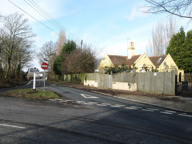
Image: © Simon Carey Taken: 20 Feb 2010
Lodge house built in the late 19th century to serve Glynleigh Manor sometimes known as Green Leas and currently as Glyndley Manor. The lodge is now a private residence and the old drive is no longer in use being diverted up the road to the southern side of Hiller's Garden Centre. The road junction is that of Hailsham Road, the B2104, and Glynleigh Road, a minor road. However the old route from Westham to Hailsham originally followed Glynleigh Road with the current route south to Stone Cross added during the 18th century.
Images are licensed for reuse under creativecommons.org/licenses/by-sa/2.0
Image Location
Latitude
50.834872
Longitude
0.273802