The Mount, Milverton
Introduction
The photograph on this page of The Mount, Milverton by Derek Harper as part of the Geograph project.
The Geograph project started in 2005 with the aim of publishing, organising and preserving representative images for every square kilometre of Great Britain, Ireland and the Isle of Man.

There are currently over 7.5m images from over 14,400 individuals and you can help contribute to the project by visiting https://www.geograph.org.uk
The Mount, Milverton
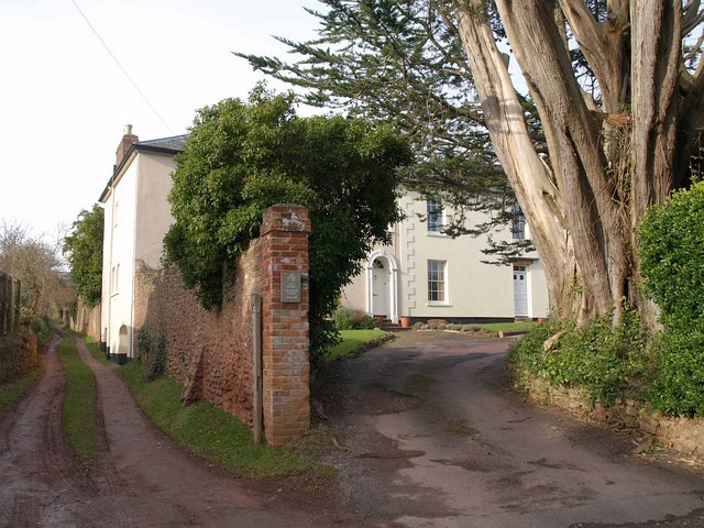
Image: © Derek Harper Taken: 1 Feb 2010
On the left, footpath WG 7/25 runs alongside Image The Mount is an early C19 house, now forming a pair of semis http://webapp1.somerset.gov.uk/her/details.asp?prn=40302 . Seen from the point where Wood Street veers northwards to leave Milverton.
Images are licensed for reuse under creativecommons.org/licenses/by-sa/2.0
Image Location
Latitude
51.027476
Longitude
-3.259057