Elderwood, Elder Road
Introduction
The photograph on this page of Elderwood, Elder Road by Stephen Richards as part of the Geograph project.
The Geograph project started in 2005 with the aim of publishing, organising and preserving representative images for every square kilometre of Great Britain, Ireland and the Isle of Man.

There are currently over 7.5m images from over 14,400 individuals and you can help contribute to the project by visiting https://www.geograph.org.uk
Elderwood, Elder Road
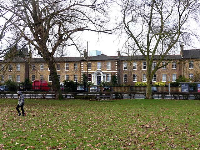
Image: © Stephen Richards Taken: Unknown
Built as a school house for the House of Industry for the Infant Poor which was established here in 1810. Grade II listed. Writing in 1983, Pevsner observed that the building's future was uncertain, but having been converted into flats it now seems safe. It is within the Elderwood Road Conservation Area.
Images are licensed for reuse under creativecommons.org/licenses/by-sa/2.0
Image Location
Latitude
51.424196
Longitude
-0.098533