Treorchy Rugby
Introduction
The photograph on this page of Treorchy Rugby by Derek Cummings as part of the Geograph project.
The Geograph project started in 2005 with the aim of publishing, organising and preserving representative images for every square kilometre of Great Britain, Ireland and the Isle of Man.

There are currently over 7.5m images from over 14,400 individuals and you can help contribute to the project by visiting https://www.geograph.org.uk
Treorchy Rugby
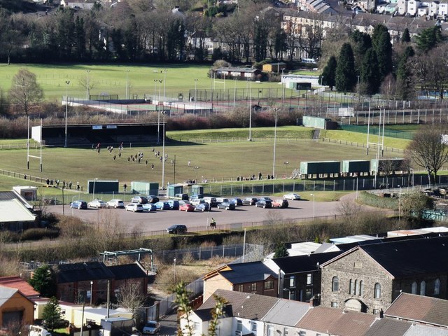
Image: © Derek Cummings Taken: 14 Feb 2010
Taken with a zoom lens looking down from Tyn y Bedw country park this shows the activity on a Sunday morning at the Rugby ground below.
Images are licensed for reuse under creativecommons.org/licenses/by-sa/2.0
Image Location
Latitude
51.65589
Longitude
-3.500475