Glandy Cross and the Cross Inn
Introduction
The photograph on this page of Glandy Cross and the Cross Inn by Natasha Ceridwen de Chroustchoff as part of the Geograph project.
The Geograph project started in 2005 with the aim of publishing, organising and preserving representative images for every square kilometre of Great Britain, Ireland and the Isle of Man.

There are currently over 7.5m images from over 14,400 individuals and you can help contribute to the project by visiting https://www.geograph.org.uk
Glandy Cross and the Cross Inn
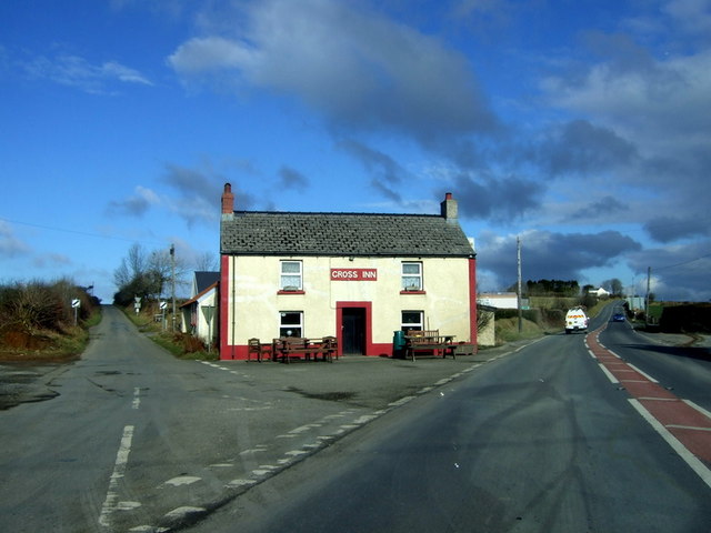
Image: © Natasha Ceridwen de Chroustchoff Taken: 9 Feb 2010
The pub faces the road intersection that the village is named for: on the right is the A478 old turnpike route heading towards Cardigan, left the minor road to Mynachclogddu. Roads also run west and east at this point. Although this is on the surface this looks a somewhat dull, flat landscape it has important prehistoric and historic roots: there is a multiplicity of Neolithic and Bronze Age remains in the area still visible, and in the Middle Ages the land (much of it owned by the Cistercians at Whitland Abbey) was held under Welsh systems of tenure and farmed communally. "Sixteenth-century leases make it clear that tenants were practising common pasturage and the survival of arian y mynydd or 'mountain silver', a payment for grazing rights, with a diversity of rents, in both cash, kind and service, suggests that they correspond with earlier villein obligations, when most of the tenants were also bound to do boon work for the monastery." Some of the moorland here remained unenclosed until the C19. See Archaeology in Wales http://www.cambria.org.uk/HLC/Preseli/area/area265.htm
Images are licensed for reuse under creativecommons.org/licenses/by-sa/2.0
Image Location
Latitude
51.907272
Longitude
-4.70056