Steep slope on the east side of Dickens Drive, Gaer, Newport
Introduction
The photograph on this page of Steep slope on the east side of Dickens Drive, Gaer, Newport by Jaggery as part of the Geograph project.
The Geograph project started in 2005 with the aim of publishing, organising and preserving representative images for every square kilometre of Great Britain, Ireland and the Isle of Man.

There are currently over 7.5m images from over 14,400 individuals and you can help contribute to the project by visiting https://www.geograph.org.uk
Steep slope on the east side of Dickens Drive, Gaer, Newport
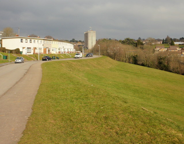
Image: © Jaggery Taken: 12 Feb 2010
For three-quarters of its length, there are no houses on the east side of Dickens Drive because the land drops away steeply towards Masefield Vale. Only at its western end, http://www.geograph.org.uk/photo/1706510 beyond Ruskin Rise, are there houses on both sides. The tall building in the background is Hillview. http://www.geograph.org.uk/photo/1515795
Images are licensed for reuse under creativecommons.org/licenses/by-sa/2.0
Image Location
Latitude
51.575625
Longitude
-3.020168