Park Grange Road and Spring Lane Tram Stop
Introduction
The photograph on this page of Park Grange Road and Spring Lane Tram Stop by P L Chadwick as part of the Geograph project.
The Geograph project started in 2005 with the aim of publishing, organising and preserving representative images for every square kilometre of Great Britain, Ireland and the Isle of Man.

There are currently over 7.5m images from over 14,400 individuals and you can help contribute to the project by visiting https://www.geograph.org.uk
Park Grange Road and Spring Lane Tram Stop
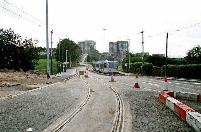
Image: © P L Chadwick Taken: Unknown
Spring lane is actually the road ahead in the distance, climbing up to the tower block on the left. Supertram No. 17 (now numbered 117) is at the stop, which when photographed was the temporary terminus on this line. Park Grange Road winds its way through large areas of social housing. In 1994 the area looked pretty run down. Maybe it has improved since then. The tram was routed this way to help with regeneration. Image
Images are licensed for reuse under creativecommons.org/licenses/by-sa/2.0
Image Location
Latitude
53.36613
Longitude
-1.43897