David's Bridge (No 90) near Nantwich, Cheshire
Introduction
The photograph on this page of David's Bridge (No 90) near Nantwich, Cheshire by Roger D Kidd as part of the Geograph project.
The Geograph project started in 2005 with the aim of publishing, organising and preserving representative images for every square kilometre of Great Britain, Ireland and the Isle of Man.

There are currently over 7.5m images from over 14,400 individuals and you can help contribute to the project by visiting https://www.geograph.org.uk
David's Bridge (No 90) near Nantwich, Cheshire
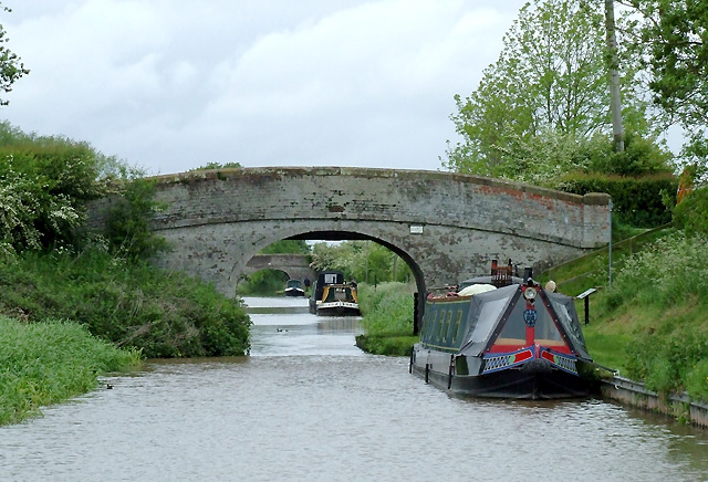
Image: © Roger D Kidd Taken: 22 May 2009
David's Bridge carries a farm track and bridleway. Marsh Lane Bridge (No 91) can be seen about three hundred metres further on. The reason bridges on this part of the canal are so drab is that several years ago some fool decided to paint them all white. The recreational "Crewe and Nantwich Circular Walk" is also routed across the bridge. This is a route around Crewe and Nantwich, passing through Weston and Acton. It is split into three sections with bus links. Old villages, historical buildings and old battle sites are visited by using ancient paths, a canal towpath and field paths. http://www.cheshire.gov.uk/countryside/Walking/circularwalks_long/crewe_nantwich/crewenantwichcircular.htm http://www.ldwa.org.uk/ldp/members/show_path.php?path_name=Crewe+and+Nantwich+Circular+Walk
Images are licensed for reuse under creativecommons.org/licenses/by-sa/2.0
Image Location
Latitude
53.057953
Longitude
-2.538855