Lancashire Fusiliers Headquarters
Introduction
The photograph on this page of Lancashire Fusiliers Headquarters by David Dixon as part of the Geograph project.
The Geograph project started in 2005 with the aim of publishing, organising and preserving representative images for every square kilometre of Great Britain, Ireland and the Isle of Man.

There are currently over 7.5m images from over 14,400 individuals and you can help contribute to the project by visiting https://www.geograph.org.uk
Lancashire Fusiliers Headquarters
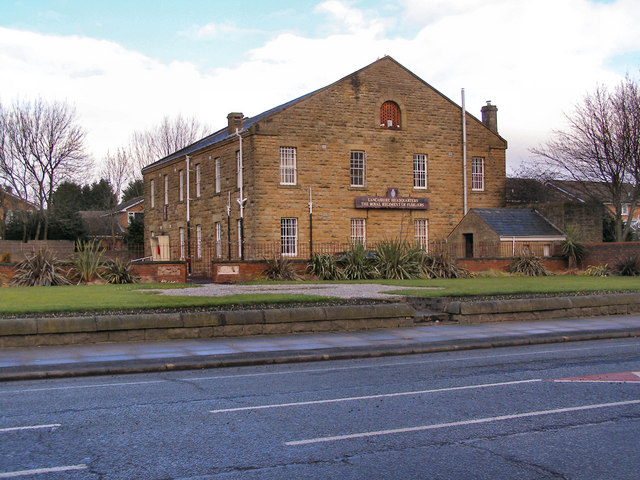
Image: © David Dixon Taken: 9 Feb 2010
Last remains of the Wellington Barracks after they were demolished to make way for new housing in the late 1960s. This building was in use as a regimental museum until recently, when the museum transferred to the centre of Bury. Image] The space where the Lutyens memorial used to stand in front of the museum (Image]) is now empty as that too has been transferred to the town centre. Image] http://www.lancs-fusiliers.co.uk/gallerynew/LFDepots/Wellingtonbarracks/wellingtonBarracks.htm http://en.wikipedia.org/wiki/Bury
Images are licensed for reuse under creativecommons.org/licenses/by-sa/2.0
Image Location
Latitude
53.588103
Longitude
-2.321624