Devonport House
Introduction
The photograph on this page of Devonport House by Derek Harper as part of the Geograph project.
The Geograph project started in 2005 with the aim of publishing, organising and preserving representative images for every square kilometre of Great Britain, Ireland and the Isle of Man.

There are currently over 7.5m images from over 14,400 individuals and you can help contribute to the project by visiting https://www.geograph.org.uk
Devonport House
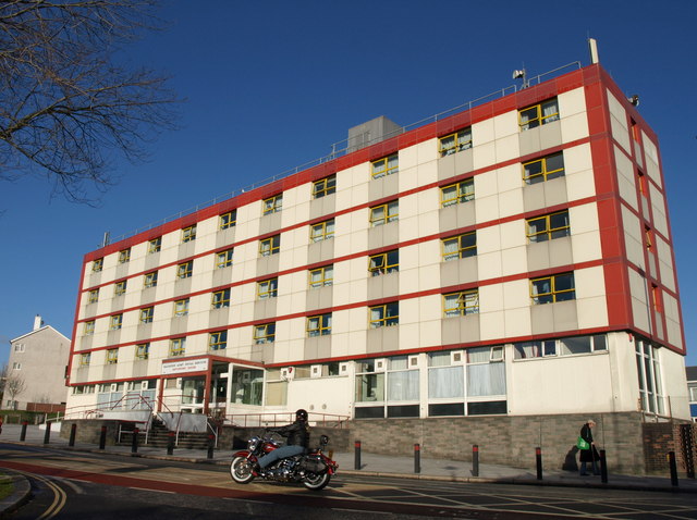
Image: © Derek Harper Taken: 30 Jan 2010
Formerly called Red Shield House, the Salvation Army hostel faces Park Avenue and Granby Way. From http://www.plymouthdata.info/Churches-Salvation%20Army.htm"On Wednesday June 16th 1965 the "Red Shield House" was opened in Park Avenue, Devonport. The ribbon, in the Army's colours, was cut by the Commissioner W F Cooper. The building was designed by Colonel W H Charles, the staff architect, and constructed at a cost of £139,000 to replace the former naval and military hostel at Rosyth House. There were 50 bedrooms plus a further 22 bed-sitting rooms, a canteen seating 80, a dining-room for 50 and various recreation rooms."
Images are licensed for reuse under creativecommons.org/licenses/by-sa/2.0
Image Location
Latitude
50.373247
Longitude
-4.176727