Site of Ryton car plant (2)
Introduction
The photograph on this page of Site of Ryton car plant (2) by Robin Stott as part of the Geograph project.
The Geograph project started in 2005 with the aim of publishing, organising and preserving representative images for every square kilometre of Great Britain, Ireland and the Isle of Man.

There are currently over 7.5m images from over 14,400 individuals and you can help contribute to the project by visiting https://www.geograph.org.uk
Site of Ryton car plant (2)
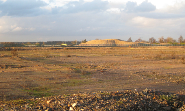
Image: © Robin Stott Taken: 5 Feb 2010
Looking across the centre of the triangular site, which covered some 45 hectares including car parks. The main building was 600 metres long. Try www.bing.com/maps and search on Ryton on Dunsmore for aerial views of the plant. The fence here has been erected across the site. The A45 runs behind the mountain of rubble. The scale is given by the lighting columns and the yellow container lorry, left of centre, about 500 metres away.
Images are licensed for reuse under creativecommons.org/licenses/by-sa/2.0
Image Location


Leaflet Map data © OpenStreetMap
Latitude
52.369058
Longitude
-1.447715