Cottages, High Street, Pevensey
Introduction
The photograph on this page of Cottages, High Street, Pevensey by Simon Carey as part of the Geograph project.
The Geograph project started in 2005 with the aim of publishing, organising and preserving representative images for every square kilometre of Great Britain, Ireland and the Isle of Man.

There are currently over 7.5m images from over 14,400 individuals and you can help contribute to the project by visiting https://www.geograph.org.uk
Cottages, High Street, Pevensey
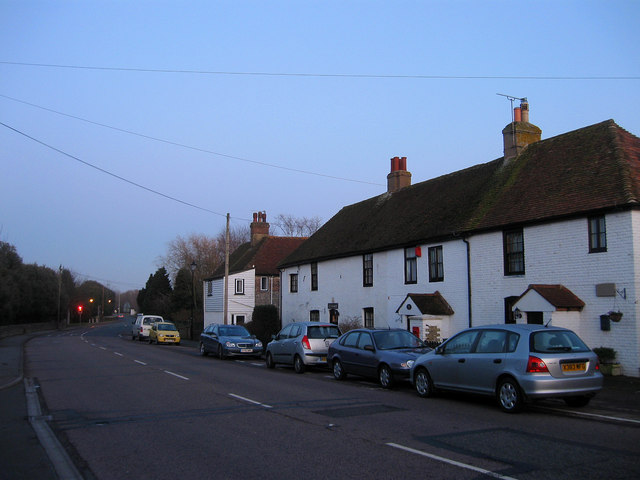
Image: © Simon Carey Taken: 6 Feb 2010
The three to the right date from 1717 and include from left to right, Camden, Post Office and Candlewick Cottages respectively. The weatherboarded building beyond is one of Kings Cottages a small terrace at right angles to the road. The traffic light in the distance marks the junction of High Street with Wallsend Road.
Images are licensed for reuse under creativecommons.org/licenses/by-sa/2.0
Image Location
Latitude
50.820542
Longitude
0.338986