
Star Inn
Introduction
The photograph on this page of Star Inn by Simon Carey as part of the Geograph project.
The Geograph project started in 2005 with the aim of publishing, organising and preserving representative images for every square kilometre of Great Britain, Ireland and the Isle of Man.

There are currently over 7.5m images from over 14,400 individuals and you can help contribute to the project by visiting https://www.geograph.org.uk
Star Inn
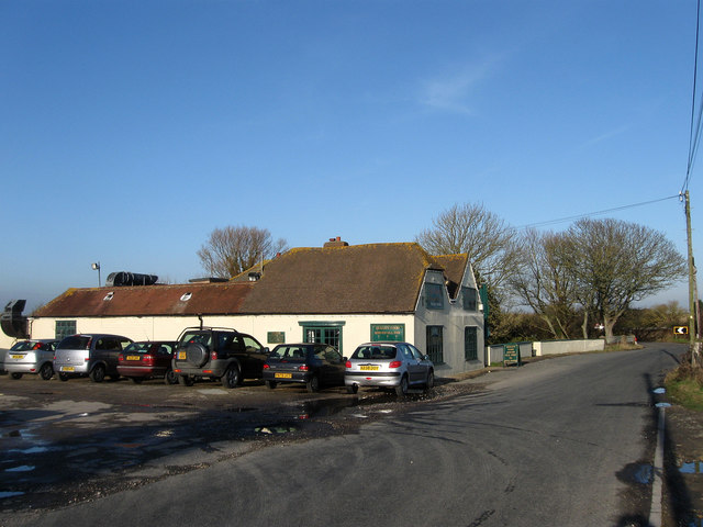
Image: © Simon Carey Taken: 6 Feb 2010
The buildings in the foreground were constructed in 1402 as a sluice keeper's cottage for the nearby Pevensey Sluice. Sometime during the Civil War of the 1640s it became an inn originally known as he Star of Bethlehem as it attracted the shepherds from the nearby marsh. Other clientele included travellers moving along the old road across the marshes from Pevensey to Hastings and during the 18th and 19th centuries local smugglers who used the inn as a meeting point and also concealed a couple of small ships in the marshes nearby. The inn's isolation was ideal for this trade as it stood at the junction of a number of paths that head north across the levels and was the site of two battles between smugglers and coastguards one in 1822 and another in 1833 which left three smugglers dead and five seriously injured after a two hour gunfight. Since then the inn has become a meeting place for holidaymakers from nearby Normans Bay and those wishing to enjoy a pub lunch out in the isolation of the marshes.
Images are licensed for reuse under creativecommons.org/licenses/by-sa/2.0
Image Location

Latitude
50.829076
Longitude
0.392667