Radnor Terrace
Introduction
The photograph on this page of Radnor Terrace by Martin Addison as part of the Geograph project.
The Geograph project started in 2005 with the aim of publishing, organising and preserving representative images for every square kilometre of Great Britain, Ireland and the Isle of Man.

There are currently over 7.5m images from over 14,400 individuals and you can help contribute to the project by visiting https://www.geograph.org.uk
Radnor Terrace
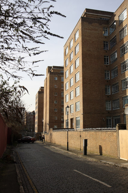
Image: © Martin Addison Taken: 1 Feb 2010
Located behind and providing access to the rear of Charles House. This cobbled street also provided access to the cleared area behind the fence on the left. The gates to Charles House yard can be seen at the end along with a couple of the staff on a smoke break and a car whose driver seems to be lost. These cobbles will probably disappear when the whole site, including Charles House, is redeveloped. This has been planned since around 2007, but have you ever tried moving a government department out of a building!
Images are licensed for reuse under creativecommons.org/licenses/by-sa/2.0
Image Location
Latitude
51.495927
Longitude
-0.205039