Church Street, Thurlaston
Introduction
The photograph on this page of Church Street, Thurlaston by Kate Jewell as part of the Geograph project.
The Geograph project started in 2005 with the aim of publishing, organising and preserving representative images for every square kilometre of Great Britain, Ireland and the Isle of Man.

There are currently over 7.5m images from over 14,400 individuals and you can help contribute to the project by visiting https://www.geograph.org.uk
Church Street, Thurlaston
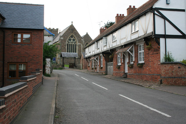
Image: © Kate Jewell Taken: 12 May 2006
New houses on the left, old cottages, with jettied 1st floor, to the right and the 12th century All Saints Church straight ahead.
Images are licensed for reuse under creativecommons.org/licenses/by-sa/2.0
Image Location
Latitude
52.590962
Longitude
-1.255984