Verney Street
Introduction
The photograph on this page of Verney Street by Alan Murray-Rust as part of the Geograph project.
The Geograph project started in 2005 with the aim of publishing, organising and preserving representative images for every square kilometre of Great Britain, Ireland and the Isle of Man.

There are currently over 7.5m images from over 14,400 individuals and you can help contribute to the project by visiting https://www.geograph.org.uk
Verney Street
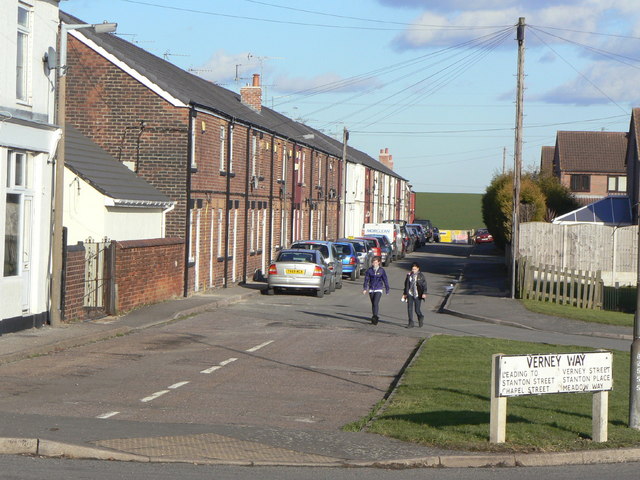
Image: © Alan Murray-Rust Taken: 31 Jan 2010
One of several terraces built off the Rotherham Road to create the miners' village of New Houghton. This one first appears on the 1898 OS maps, and was originally terraced on both sides. The area between it and Stanton Street has been redeveloped with more modern housing.
Images are licensed for reuse under creativecommons.org/licenses/by-sa/2.0
Image Location
Latitude
53.183449
Longitude
-1.253705