Gotherington County Primary School
Introduction
The photograph on this page of Gotherington County Primary School by Tenikwa as part of the Geograph project.
The Geograph project started in 2005 with the aim of publishing, organising and preserving representative images for every square kilometre of Great Britain, Ireland and the Isle of Man.

There are currently over 7.5m images from over 14,400 individuals and you can help contribute to the project by visiting https://www.geograph.org.uk
Gotherington County Primary School
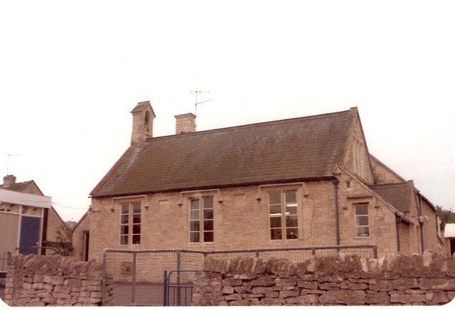
Image: © Tenikwa Taken: 6 Jun 1982
This picture was taken in 1982 and shows the school in the last few years of its life at the original premises. It has since been converted into a private house. In view of this writer, the conversion was done with little sensitivity and many of the original features were lost.
Images are licensed for reuse under creativecommons.org/licenses/by-sa/2.0
Image Location
Latitude
51.965133
Longitude
-2.059046