Stamford Hill
Introduction
The photograph on this page of Stamford Hill by Stephen McKay as part of the Geograph project.
The Geograph project started in 2005 with the aim of publishing, organising and preserving representative images for every square kilometre of Great Britain, Ireland and the Isle of Man.

There are currently over 7.5m images from over 14,400 individuals and you can help contribute to the project by visiting https://www.geograph.org.uk
Stamford Hill
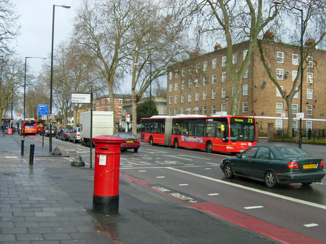
Image: © Stephen McKay Taken: 29 Jan 2010
Stamford Hill is both the name of this road, part of the A10 leading north out of London, and the surrounding suburb sandwiched between Stoke Newington and Tottenham. The 'bendybus' is heading towards Victoria on the frequent 73 route.
Images are licensed for reuse under creativecommons.org/licenses/by-sa/2.0
Image Location
Latitude
51.569809
Longitude
-0.072405