
Sallyport Tower
Introduction
The photograph on this page of Sallyport Tower by Andrew Curtis as part of the Geograph project.
The Geograph project started in 2005 with the aim of publishing, organising and preserving representative images for every square kilometre of Great Britain, Ireland and the Isle of Man.

There are currently over 7.5m images from over 14,400 individuals and you can help contribute to the project by visiting https://www.geograph.org.uk
Sallyport Tower
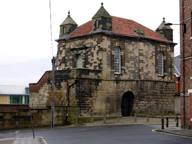
Image: © Andrew Curtis Taken: 24 Jan 2010
Walknoll, Sallyport or (Ships) Carpenters' Tower was originally a tower on the C14 Town Wall which had been realigned to include the district of Pandon. It was constructed around 1307 at a point on a small hill where the wall changed direction and was rectangular rather than the usual D-shape of the other wall towers. In 1716 the Shipwrights' Company enlarged the tower, and built a hall on the first floor with access by stairs at the East end. The Company retained it until the mid-C19 after which it had a number of uses and was rescued from dereliction and possibly demolition in the 1960s. It is a Grade I, Listed Building. Tyne and Wear HER (1562): Newcastle town wall, Wallknoll or Sallyport Tower http://www.twsitelines.info
Images are licensed for reuse under creativecommons.org/licenses/by-sa/2.0
Image Location

Latitude
54.971232
Longitude
-1.603663