Somerton Place, Newport
Introduction
The photograph on this page of Somerton Place, Newport by Jaggery as part of the Geograph project.
The Geograph project started in 2005 with the aim of publishing, organising and preserving representative images for every square kilometre of Great Britain, Ireland and the Isle of Man.

There are currently over 7.5m images from over 14,400 individuals and you can help contribute to the project by visiting https://www.geograph.org.uk
Somerton Place, Newport
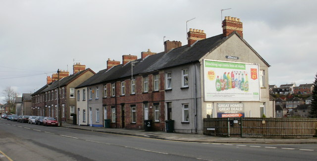
Image: © Jaggery Taken: 24 Jan 2010
Though located on Chepstow Road, immediately east of the Aberthaw Road junction, these 2 terraced blocks, containing 16 houses, have retained the street name Somerton Place. The same applies to Bolts Row, http://www.geograph.org.uk/photo/1680263 located immediately east of Somerton Place. A small part of Bolts Row is visible in the distance, two buildings with their roofs orientated at 90 degrees to those in Somerton Place.
Images are licensed for reuse under creativecommons.org/licenses/by-sa/2.0
Image Location
Latitude
51.588735
Longitude
-2.958393