Downham Community Centre
Introduction
The photograph on this page of Downham Community Centre by Stephen Craven as part of the Geograph project.
The Geograph project started in 2005 with the aim of publishing, organising and preserving representative images for every square kilometre of Great Britain, Ireland and the Isle of Man.

There are currently over 7.5m images from over 14,400 individuals and you can help contribute to the project by visiting https://www.geograph.org.uk
Downham Community Centre
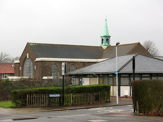
Image: © Stephen Craven Taken: 25 Jan 2010
Between the years 1929 to 1930 on the corner of Shroffold Road and Downham Way the Methodists built a Church, Halls and Manse. The church closed as such in 1974, and the Greater London Council (who had originally developed the area) exercised its pre-emptive right to re-purchase the whole site and did so at an agreed price of £17,200. The former church and adjacent halls now form a community centre. [for a detailed history see: http://www.downhamcomcentre.org.uk/about2.html ]
Images are licensed for reuse under creativecommons.org/licenses/by-sa/2.0
Image Location
Latitude
51.4261
Longitude
0.003103