Maesycwmmer - Hengoed Viaduct
Introduction
The photograph on this page of Maesycwmmer - Hengoed Viaduct by Robin Drayton as part of the Geograph project.
The Geograph project started in 2005 with the aim of publishing, organising and preserving representative images for every square kilometre of Great Britain, Ireland and the Isle of Man.

There are currently over 7.5m images from over 14,400 individuals and you can help contribute to the project by visiting https://www.geograph.org.uk
Maesycwmmer - Hengoed Viaduct
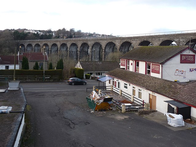
Image: © Robin Drayton Taken: 23 Jan 2010
The viaduct was built in the 1850s to carry the Taff Vale Extension of the Newport, Abergavenny and Hereford Railway over the Rhymney valley. It closed to railway traffic in 1964. It has 16 arches, is 284 yards long and 120 feet high. In 2000 it was opened for public access and is now part of National Cycle Route 47, the Celtic Way Cycle Route and the Rhymney Valley Ridgeway Walk. In the foreground, the Butchers Arms is obviously undergoing renovation.
Images are licensed for reuse under creativecommons.org/licenses/by-sa/2.0
Image Location
Latitude
51.646514
Longitude
-3.223526