WW2 Control tower, West Malling/ Kings Hill, Kent
Introduction
The photograph on this page of WW2 Control tower, West Malling/ Kings Hill, Kent by rob as part of the Geograph project.
The Geograph project started in 2005 with the aim of publishing, organising and preserving representative images for every square kilometre of Great Britain, Ireland and the Isle of Man.

There are currently over 7.5m images from over 14,400 individuals and you can help contribute to the project by visiting https://www.geograph.org.uk
WW2 Control tower, West Malling/ Kings Hill, Kent
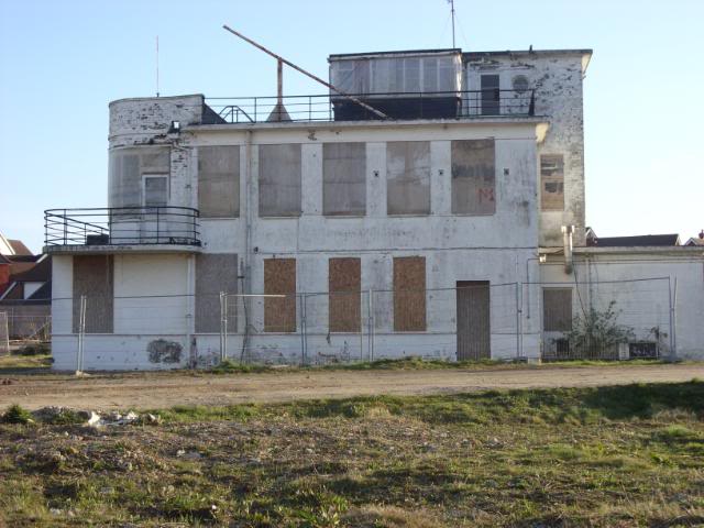
Image: © rob Taken: 13 Feb 2009
Originally used as a landing area during the first World War, the site opened as a private landing ground and in 1930, then known as Kingshill, home to the Maidstone School of Flying, before being renamed West Malling Airfield, and, in 1932, Maidstone Airport. As war approached, the airfield was taken over by the military, to become RAF West Malling in 1940, serving in the front line against the Luftwaffe. The station saw further service after the war, first with some of the RAFs first jet squadrons, and later as US Naval Air Station. After closure as an operational air station in 1969, West Malling acquired a more civilian guise, hosting several major Great Warbirds Air Displays during the 70s and 80s, until eventually closing completely as an airfield. The site is now developing into a new village community of mixed residential, commercial, and civic amenities, but still retains several features of its military aviation heritage. (from http://military-genealogy.forcesreunited.org.uk/3035/RN_Air_Station_West_Malling ) The control tower now lays abandoned and waiting restoration and eventual new use.
Images are licensed for reuse under creativecommons.org/licenses/by-sa/2.0
Image Location
Latitude
51.271406
Longitude
0.396366