Lower Broadheath Church
Introduction
The photograph on this page of Lower Broadheath Church by Philip Halling as part of the Geograph project.
The Geograph project started in 2005 with the aim of publishing, organising and preserving representative images for every square kilometre of Great Britain, Ireland and the Isle of Man.

There are currently over 7.5m images from over 14,400 individuals and you can help contribute to the project by visiting https://www.geograph.org.uk
Lower Broadheath Church
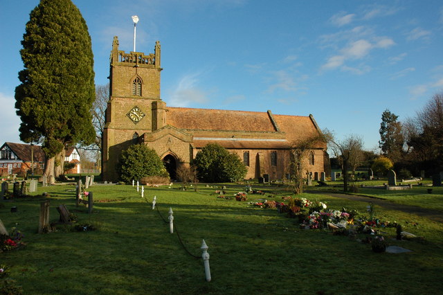
Image: © Philip Halling Taken: 24 Jan 2010
Christ Church in Lower Broadheath dates from 1903-4 by C. Ford Whitcombe. Pevsner describes the church as 'quite large, but of no special architectural interest'.
Images are licensed for reuse under creativecommons.org/licenses/by-sa/2.0
Image Location
Latitude
52.213228
Longitude
-2.278327