Nash Community Hall
Introduction
The photograph on this page of Nash Community Hall by Jaggery as part of the Geograph project.
The Geograph project started in 2005 with the aim of publishing, organising and preserving representative images for every square kilometre of Great Britain, Ireland and the Isle of Man.

There are currently over 7.5m images from over 14,400 individuals and you can help contribute to the project by visiting https://www.geograph.org.uk
Nash Community Hall
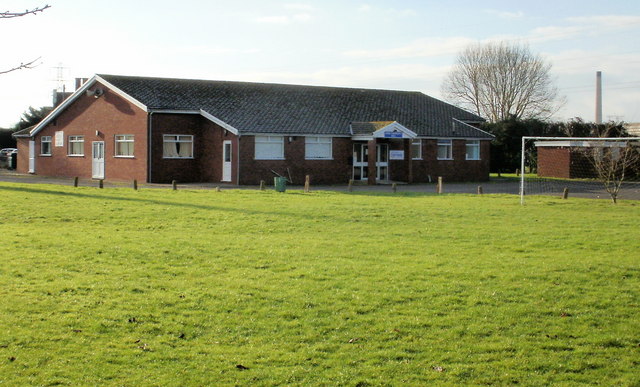
Image: © Jaggery Taken: 23 Jan 2010
Nash is a small village (2001 census population 281) on the Caldicot Levels, on the outskirts of Newport. Shown here is Nash Community Hall, which is used by groups from the village and surrounding areas. At the centre of the community is the village church, http://www.geograph.org.uk/photo/1674676. Next to the church is the village pub, the Waterloo Inn. http://www.geograph.org.uk/photo/1674695
Images are licensed for reuse under creativecommons.org/licenses/by-sa/2.0
Image Location
Latitude
51.548349
Longitude
-2.948891