Burn of Fochabers
Introduction
The photograph on this page of Burn of Fochabers by Anne Burgess as part of the Geograph project.
The Geograph project started in 2005 with the aim of publishing, organising and preserving representative images for every square kilometre of Great Britain, Ireland and the Isle of Man.

There are currently over 7.5m images from over 14,400 individuals and you can help contribute to the project by visiting https://www.geograph.org.uk
Burn of Fochabers
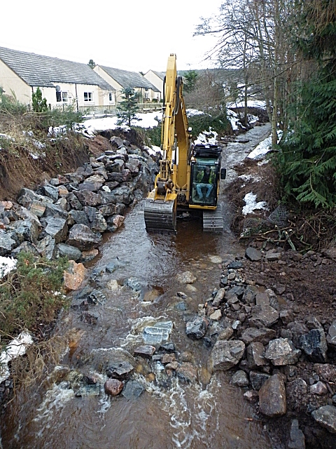
Image: © Anne Burgess Taken: 19 Jan 2010
The digger is shifting a load of huge boulders to the right bank of the burn (the left of this view looking upstream) to prevent further erosion of the bank next to Christie Place in the event of another spate. See Image] for the same view during the height of the flood.
Images are licensed for reuse under creativecommons.org/licenses/by-sa/2.0
Image Location
Latitude
57.61207
Longitude
-3.098111