South Street, Horncastle
Introduction
The photograph on this page of South Street, Horncastle by Dave Hitchborne as part of the Geograph project.
The Geograph project started in 2005 with the aim of publishing, organising and preserving representative images for every square kilometre of Great Britain, Ireland and the Isle of Man.

There are currently over 7.5m images from over 14,400 individuals and you can help contribute to the project by visiting https://www.geograph.org.uk
South Street, Horncastle
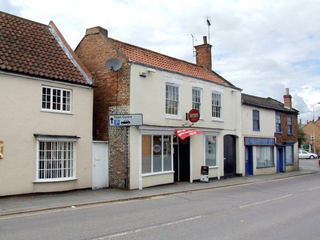
Image: © Dave Hitchborne Taken: 18 Jul 2009
At No.6 is Harpers Bar pub, which sells keg beer, as I'm led to believe. To the left at Nos.8-12 is The Street Lamp - FH Manning Financial Services. To the right are what appear to be two private dwellings at No.s 4 and 4a, but No.4a is listed as Garage Services. Beyond is the A158 Lincoln to Skegness road and North Street, under which runs the River Waring. North Street is the A153 to Louth. South Street is the A153 to Sleaford, but heading south on the B1192, just east of Coningsby, will take you to Boston.
Images are licensed for reuse under creativecommons.org/licenses/by-sa/2.0
Image Location
Latitude
53.207462
Longitude
-0.114858