Radcliffe Primary Care Centre
Introduction
The photograph on this page of Radcliffe Primary Care Centre by David Dixon as part of the Geograph project.
The Geograph project started in 2005 with the aim of publishing, organising and preserving representative images for every square kilometre of Great Britain, Ireland and the Isle of Man.

There are currently over 7.5m images from over 14,400 individuals and you can help contribute to the project by visiting https://www.geograph.org.uk
Radcliffe Primary Care Centre
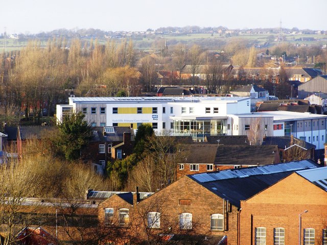
Image: © David Dixon Taken: 17 Jan 2010
The new health centre's large and distinctive white fascia makes it easily visible from a distance. Here seen from Coronation Park, viewing above the houses and industrial premises of Church Street, Milltown Street and Irwell Street.
Images are licensed for reuse under creativecommons.org/licenses/by-sa/2.0
Image Location
Latitude
53.560613
Longitude
-2.322985