Former Town Hall
Introduction
The photograph on this page of Former Town Hall by David Dixon as part of the Geograph project.
The Geograph project started in 2005 with the aim of publishing, organising and preserving representative images for every square kilometre of Great Britain, Ireland and the Isle of Man.

There are currently over 7.5m images from over 14,400 individuals and you can help contribute to the project by visiting https://www.geograph.org.uk
Former Town Hall
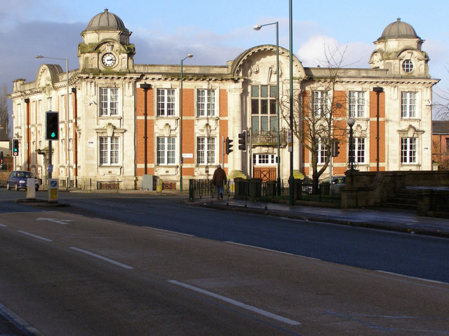
Image: © David Dixon Taken: 17 Jan 2010
The town hall was built in 1911 on the junction of Water Street and Spring Lane. It formed the public administrative centre for the district until, under the Local Government Act 1972 the town's urban district status was abolished, and Radcliffe became, and has been since 1 April 1974,an unparished area of the Metropolitan Borough of Bury. The building remained unoccupied for many years and now it is used as private accommodation
Images are licensed for reuse under creativecommons.org/licenses/by-sa/2.0
Image Location
Latitude
53.562764
Longitude
-2.328271