Aerial view of the 'Finches' estate, Thundersley
Introduction
The photograph on this page of Aerial view of the 'Finches' estate, Thundersley by Edward Clack as part of the Geograph project.
The Geograph project started in 2005 with the aim of publishing, organising and preserving representative images for every square kilometre of Great Britain, Ireland and the Isle of Man.

There are currently over 7.5m images from over 14,400 individuals and you can help contribute to the project by visiting https://www.geograph.org.uk
Aerial view of the 'Finches' estate, Thundersley
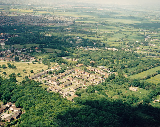
Image: © Edward Clack Taken: 5 Jun 1987
The 'Finches' is a small estate lies to the west of Thundersley Common. In the picture, the northern part of Thundersley Common occupies the lower right. The Finches is a winding road that occupies much of this estate just below centre.
Images are licensed for reuse under creativecommons.org/licenses/by-sa/2.0
Image Location
Latitude
51.574923
Longitude
0.587227