Aerial view of Thundersley Common and the Southend Arterial Road
Introduction
The photograph on this page of Aerial view of Thundersley Common and the Southend Arterial Road by Edward Clack as part of the Geograph project.
The Geograph project started in 2005 with the aim of publishing, organising and preserving representative images for every square kilometre of Great Britain, Ireland and the Isle of Man.

There are currently over 7.5m images from over 14,400 individuals and you can help contribute to the project by visiting https://www.geograph.org.uk
Aerial view of Thundersley Common and the Southend Arterial Road
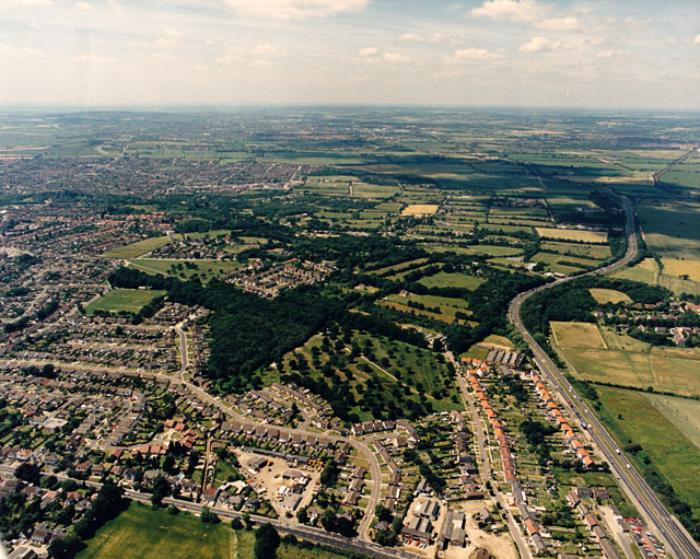
Image: © Edward Clack Taken: 10 Jul 1987
The Southend Arterial Road (A127) runs from the lower right upwards into the distance (and London). Thundersley Common is hourglass-shaped. The northern part lies just below centre and comprises open parkland with scattered trees and heathland, with a wooded part to the left. The southern part lies to the left of centre, and has some woodland, some scattered trees and some heathland. The narrow waist between is wooded.
Images are licensed for reuse under creativecommons.org/licenses/by-sa/2.0
Image Location
Latitude
51.575893
Longitude
0.592189